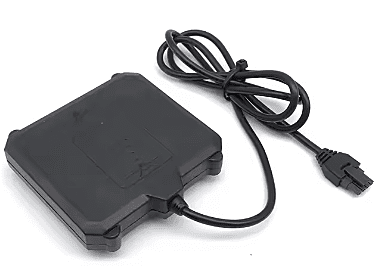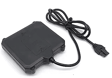


PALADIN-GROUND RADAR
The PALADIN Ground Radar is a specialized Ground Penetrating Radar (GPR) system designed for drone and robotic integration. It non-invasively detects underground objects and features, ideal for mapping utilities, archaeological surveys, and geological analysis. This compact, high-resolution sensor enhances aerial inspection capabilities for various industrial applications.
Features :
Non-invasive underground object detection.
High-resolution subsurface mapping.
Ideal for drone and robotics integration.
Detects pipes, cables, and anomalies.
Aids in archaeological surveys.
Valuable for geological analysis.
Compact and lightweight design.
Enhances aerial inspection capabilities.
Robust for demanding field use.
Essential for civil engineering.
Technical Specifications:
Model: PALADIN-GROUND RADAR
Type: Ground Penetrating Radar (GPR)
Frequency Range: GPR systems use various frequencies for different penetration depths and resolutions. Typical ranges could be 400MHz-2GHz or specific single frequencies.
Detection Depth: Highly dependent on frequency and ground material, usually from a few centimeters to several meters.
Scan Modes: Likely continuous scan or point-by-point.
Output Data: Raw radar data, processed profiles, or 3D visualizations. Typically digital output via Ethernet, USB, or CAN.
Integration Interface: e.g., Ethernet, USB, CAN, dedicated flight controller interface.
Working Voltage: Standard drone power, e.g., 12V-24V.
Power Consumption: Varies, but optimized for drone battery life.
Operating Temperature: Suitable for field conditions, e.g., -10°C to +50°C.
Dimensions: Specific to the GPR antenna and control unit, but compact for drone mounting.
Weight: Designed to be as lightweight as possible for drone payload efficiency.
Additional Details:
Manufacturer: PALADIN
Brand: PALADIN
Generic Name: Ground Penetrating Radar || GPR || Subsurface Mapping Sensor || Underground Utility Detector || Drone GPR || Robotics GPR || Geological Sensor || Archeological Sensor || Non-Destructive Testing (NDT) Sensor || UAV GPR
Sold By: UAV Marketplace (an authorized seller of drone gear and accessories)
Ideal For: Utility Mapping (pipes, cables) || Archaeological Surveys || Geological Surveys || Environmental Site Assessments || Construction Site Analysis || Road and Bridge Inspection || Mining Operations || Precision Agriculture (soil mapping) || Search and Rescue (buried objects) || Custom Drone-based Surveying
Package Details:
Includes:
1x PALADIN-GROUND RADAR Unit (GPR antenna and control unit)
Frequently Asked Questions:
Q1. What types of objects can the PALADIN Ground Radar detect underground?
Ans. The PALADIN Ground Radar, being a Ground Penetrating Radar (GPR) system, can detect a variety of underground objects and features non-invasively. This includes metallic and non-metallic utilities like water pipes, gas lines, electrical cables, and communication lines. It can also identify buried foundations, rebar in concrete structures, archaeological artifacts, geological strata, voids, and changes in soil composition, making it versatile for various subsurface investigations.
Q2. How does a drone-mounted GPR system compare to a handheld or cart-based GPR system?
Ans. A drone-mounted GPR system like the PALADIN offers significant advantages over traditional handheld or cart-based systems, especially for large areas or difficult terrain. Drones can cover vast expanses much faster, access inaccessible areas (steep slopes, dangerous sites), and collect data more consistently without ground interference. While handheld systems offer direct tactile control, drone GPR excels in efficiency, safety, and generating comprehensive, georeferenced datasets for mapping.
Q3. What kind of data does the PALADIN Ground Radar produce, and how is it interpreted?
Ans. The PALADIN Ground Radar typically produces raw radar data, often visualized as 2D profiles or "radargrams," which show reflections from subsurface features over distance. These radargrams are then processed using specialized GPR software to remove noise, enhance signals, and create clearer images. From these, trained professionals can interpret the presence, depth, and sometimes the type of buried objects. For comprehensive mapping, multiple 2D lines can be combined to generate 3D subsurface models.


