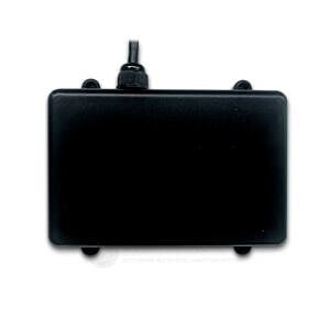


JIYI Terrain Radar Sensor
The JIYI Terrain Radar Sensor enables precise terrain following for agricultural and industrial drones. Utilizing advanced 24GHz radar, it accurately measures ground clearance, allowing the drone to maintain a constant height above undulating terrain. This ensures uniform spraying or precise mapping, boosting efficiency and safety in complex environments.
Features :
Advanced 24GHz terrain following radar.
Accurate ground clearance measurement.
Enables constant altitude above terrain.
Essential for precision agriculture.
Works reliably in all weather conditions.
High sensitivity and anti-interference.
Fast and stable signal transmission.
Compatible with JIYI K++ and KX flight controllers.
Enhances spraying uniformity and efficiency.
Durable and robust construction.
Technical Specifications:
Model: JIYI Terrain Radar Sensor
Modulation Mode: FMCW (Frequency Modulated Continuous Wave)
Centre Frequency: 24.125GHz Common for JIYI terrain radars.
Detection Range (Altitude): 1 to 30 meters This is a common range for terrain following.
Accuracy: 0.1 meters
Resolution: 0.6 meters
Output Frequency: 40Hz (data refresh rate)
Working Voltage: 9-28V
Power Consumption: 3.0W @ 25°C
Working Temperature: -20°C to +85°C
Protection Level: IP67 (Dust tight and protected from immersion in water)
Output Interface: CAN (Controller Area Network) Bus
Dimensions: Approximately 67.5mm x 66mm x 16.5mm (Often similar form factor to obstacle avoidance radars.
Weight: Approximately 80g
Additional Details:
Manufacturer: JIYI UAV (JIYI Technology Co., Ltd.)
Brand: JIYI
Generic Name: Terrain Following Radar || Terrain Sensor || Altitude Radar || Drone Altimeter || Agricultural Drone Sensor || UAV Terrain Sensor || Ground Tracking Radar || Smart Sensor || Robotics Radar || Millimeter-Wave Radar
Sold By: UAV Marketplace (an authorized seller of drone gear and accessories)
Ideal For: Agricultural Spraying Drones || Precision Farming UAVs || Industrial Inspection Drones (over uneven terrain) || Surveying and Mapping Drones (low altitude) || Autonomous Terrain Following Systems || Plant Protection Drones || Forestry Drones || Mining Drones || Drone Safety Enhancement || Custom Large Drone Builds
Package Details:
Includes:
1x JIYI Terrain Radar Sensor
Frequently Asked Questions:
Q1. How does the JIYI Terrain Radar Sensor enable "terrain following" for a drone?
Ans. The JIYI Terrain Radar Sensor continuously measures the drone's precise distance to the ground using 24GHz radar technology. This real-time altitude data is fed to the flight controller. The flight controller then intelligently adjusts the drone's height to maintain a constant, pre-set distance above the undulating terrain. This "terrain following" capability is vital for applications like agricultural spraying, ensuring uniform coverage regardless of ground variations.
Q2. What are the benefits of using radar over other sensors (like LiDAR or ultrasonic) for terrain following?
Ans. Radar offers significant advantages for terrain following, especially in real-world agricultural and industrial settings. Unlike LiDAR, which can be affected by dust, water droplets, or direct sunlight, or ultrasonic sensors, which have limited range and are sensitive to wind, radar performs reliably in challenging conditions like fog, rain, dust, and at night. Its robust penetration ensures consistent and accurate ground clearance measurements in varied environments.
Q3. Is the JIYI Terrain Radar Sensor difficult to integrate with a non-JIYI flight controller?
Ans. The JIYI Terrain Radar Sensor communicates primarily via a CAN (Controller Area Network) interface and is specifically optimized for seamless integration with JIYI's own K++ and KX series flight controllers, which have native support for its protocol. While CAN bus is a standard, using it with non-JIYI flight controllers would likely require custom firmware development or a dedicated CAN-to-UART/PWM converter and drivers to interpret JIYI's specific data packets, making it more complex than plug-and-play.


