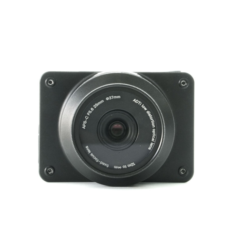


ADTI 26S V2 25mm Mapping Camera (Sample)
The ADTI 26S V2 is a high-resolution, lightweight 25mm lens mapping camera designed specifically for UAV photogrammetry. It captures precise aerial imagery essential for creating accurate 2D maps and 3D models. This sample unit provides an opportunity to evaluate its performance for professional surveying and mapping applications.
Features:
APS-C Sony CMOS back-illuminated sensor.
Mechanical shutter combined with fixed focus lenses.
Built-in Multi-Interface hot shoe output for PPK
Directly Geo-tagging function with Pixhawk (need ADTI POS&CTRL unit)
Full aluminum structure
light in weight (camera body 122 g)
compact in size (77*62*38.7 mm)
ABS injection molded case
24MP APS-C
Specification:
Image Sensor
Sensor Type:CMOS
Sensor Manufacturer:Sony
Sensor model: Sony IMX 571 back-illuminated
Effective Megapixels:26.1
Sensor Format:APS-C
Sensor size:368.95mm2 (23.5*15.7mm) Diagonal 28.3 mm (Type1.8)
Pixel Type:3.76 μm (H) × 3.76 μm (V)
Aspect Ratio:3:2
Anti Aliasing Filter:None
Color Depth (bits):25.6
Maximum Effective ISO:2,749
Image Capture
Image Resolution:
6252 x 4168(26 MP, 3:2)
4800 x 3200 (15.4 MP, 3:2)
3680 x 2456 (9.0 MP, 3:2)
4800 x 3200 (15.4 MP, 3:2)
3680 x 2456 (9.0 MP, 3:2)
2400 x 1600 (3.8 MP, 3:2)
Image File Format:JPEG
Shutter:
Shutter Type: Lightweight inter-mirror mechanical, replaceable
Shutter speed: 1/100 to 1/10000
Continuous-mode frames/second:2.0
Expo interval: ≥0.5s
Video Capture
Video Resolution:
1920x1080 (60p(28Mbps)
640x480 (30p(3Mbps))
Video File Format: MP4
HD Video Out:Yes
HD Video Connection:HDMI
Lens & Optics
25mm fixed lens
Manual fixed focus (ortho)NON-interchangeable
37.5mm equivalent Focal Length
FOV: D 58.7° H 50.0° V 34.4°
distortion<0.5%
Auto Focus No
Manual Focus Yes
Focusing range: 20 meters to infinity
Aperture fixed F5.6
35mm fixed lens:
Manual fixed focus (ortho)NON-interchangeable
52mm equivalent Focal Length
FOV: D 44.1° H 37.2° V 25.3°
distortion<0.02%
Auto Focus No
Manual Focus Yes
Focusing range: 20 meters to infinity
Aperture fixed F5.6
16mm fixed lens:
Manual fixed focus (ortho)NON-interchangeable
24.5mm equivalent Focal Length
FOV: D 83.0° H 73.0° V 52.0°
distortion<0.01%
Auto Focus No
Manual Focus Yes
Focusing range: 20 meters to infinity
Aperture fixed F5.6
Camera
Camera Size: 6.88*4.85*6.25 cm
Weight with lens: 110 g (Aluminum case)
Package Size: 14.5*10*6 cm
Package Weight: 500 g
Power: 12-28V DC Lipo or Liion
Operating Temperature: -10 to 40°C
Package Include:
1 X ADTi 24MP 24L V2 Surveyor Lite Drone Mapping Camera
1 X Setting Display
1 X TX30 connector male
1 X Multi cable
1 X HDMI cable
1 X USB cable
Additional Details:
Manufacturer: ADTI
Brand: ADTI
Generic Names: Drone camera, UAV mapping camera, photogrammetry camera, aerial survey sensor
Sold By: UAV Marketplace (an authorized seller of drone gear and accessories)
Ideal For: Professional aerial surveying, photogrammetry, large-area mapping, 3D modeling, agricultural monitoring, infrastructure inspection.
Frequently Asked Questions:
Q1: Is the 'Sample' unit fully functional?
ANS: Yes, 'Sample' typically means it is for evaluation; it should be fully functional, but check warranty/support limitations.
Q2: What drone is this camera compatible with?
ANS: t is designed for professional fixed-wing or multi-rotor mapping UAVs with sufficient payload capacity and power.
Q3: What software is needed to process the images?
ANS: Standard photogrammetry software like Pix4D, Agisoft Metashape, or similar tools are required.


